Organizers: State Key Laboratory of Remote Sensing Science, Beijing Normal University
Tutors: Jean-Philippe Gastellu-Etchegorry (CESBIO), Tiangang Yin, Jianbo Qi, Biao Cao
Language: English, with Chinese and French support
Number of participants: 30 persons
Information:
- Workshop is free of charge for research and education. Accommodation is on participants own expenses.
- The workshop is from 9am to 6pm every day.
- Participant should come with a laptop (32/64 bits Windows/Linux system, RAM 4 Gb), a free DART license to get at https://www.dart.omp.eu, and expected scientific questions to be discussed during the workshop.
The DART model | DART simulates the 3D radiative budget, chlorophyll fluorescence and RS (satellite / airborne / terrestrial) observation (spectroradiometer images, LiDAR waveform / photon counting), from visible to thermal infrared for natural and urban landscapes. It is a reference tool for RS studies (RS sensitivity to experimental and instrumental configurations, inversion of RS images, design of new RS sensor,…) and for teaching RS / radiative budget physical bases. DART is developed at CESBIO (www.cesbio.ups-tlse.fr) since 1992, with the support of Paul Sabatier University, CNES and CNRS. |
Objective of the training | To discover / deepen DART theory, functionalities and use in 5 steps: 1) Short review of physical bases 2) DART theory, functionalities and examples of applications, 3) DART overview with a realistic 3D landscape 4) DART case studies: schematic and realistic exercises 5) Case study of each participant. |
Program of the training
| 1. Short review of physical bases of optical remote sensing Radiance, reflectance, emissivity, brightness temperature,… Landscape BOA and TOA radiance, radiative budget,… |
Program of the training
| 2. DART theory, Functionalities and examples of Applications a) Theory: flux / photon tracking methods, discrete ordinates,… b) Major functionalities ● Flux tracking (modes R, T, R+T), Monte Carlo, LiDAR. ● Landscape modeling, etc. c) Examples of applications ● Fluorescence ● Preparation of ESA thermal infrared satellite ● Training of Artificial intelligence algorithm for tree detection ● Mapping urban radiative budget with high spatial resolution satellite images
3. DART overview with a realistic 3D landscape ● Work packages (WPs: DART simulations) and the DART User Manual that presents them, are in the DART web site (https://dart.omp.eu). ● Interactive presentation of DART functionalities with existing simulation:WP0A ● Modification of the existing simulation for illustrating: - Landscape reflectance spectra (WP0B): multi-spectral simulation + LUT. - Reflectance as a function of LAI (WP0C): sequencer tool + LUT. - Time series of landscape reflectance (WP0D): sequencer + LUT time mode. - Topography and trees (WP0E). - LiDAR (WP0G), cloud (WP0F).
4. DART case studies: schematic and realistic exercises 4.a Flat surfaces - VIS / NIR / TIR spectral domains : WP1 and WP2 DART functionalities are manipulated with 2D landscapes for reflectance and thermal infrared applications: landscape creation, irradiance / albedo / exitance images, radiance / reflectance / brightness temperature directional images, radiative budget,… Example of case studies: for which experimental / instrumental configuration, can we detect a fire in a thermal infrared (TIR) pixel? Can we distinguish ice and ground TIR pixels with the same thermodynamic temperature? 4.b Simulation of complex landscapes and configurations: WP3 to WP11 Depending on participants, specific applications are studied: - Atmosphere simulation: gas and aerosol models, atmosphere geometry,… - Creation of complex forest, agricultural or urban scene with topography, etc. - Importation of 3D elements and /or landscapes. - Simulation of fluorescence, etc. - Correction of topographic effects on remotely sensed images. - LiDAR: waveform, solar noise, 3D points derived from waveforms,… - Radiative budget: forest, urban landscape,…
5. Implementation by each participant of his(her) own case study Participants can work on their case studies, provided they come with convenient data (DEM, description of tree plantation, urban geometric database, etc.). They are advised to contact the tutors in advance. |
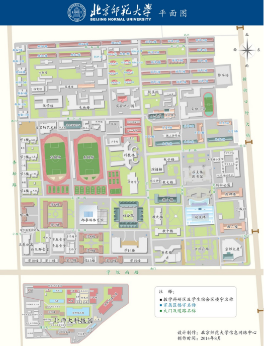
Venue: Shengdi Building 180, Xinjiekouwai Street No.19, Beijing Normal University, Beijing, China

Registration contacts: Donghui Xie, Email: xiedonghui@bnu.edu.cn, Phone: (+8610)58805042
Jing Wei, Email: weijing@bnu.edu.cn, Phone: (+8610)58802179
Registration Table :
Fill the table below and then send it to the contactor.
Name | occupation | affiliation | Phone | Study field | Did you use DART model before ? | |
| Student Research Other |
|
|
|
|
|